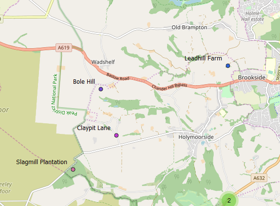
This article describes some informal/experimental work in which various sources of data were processed to find traces of mining history in the names of places.

The Geographic Area
My area of interest is broadly-speaking the Peak District and adjacent areas. For practical purposes, I have defined both a detailed boundary and a rectangular bounding box. The latter takes in all of the former, which is defined using Parish (and similar town/urban) boundaries. Since the boundary of Sheffield stretches into outlying areas which are of interest, this way of defining the boundary ends up including the city and Eastern areas. The same is not the case for Greater Manchester. Noteworthy cases where areas outside the Peak District are included are: the Churnet Valley and Alderley Edge.
The bounding box is (E-min, N-min, E-max, N-max): (381355, 340577, 445079, 402069)
Coordinates will either use fully-numerical eastings and northings to 1m, or use 100km letters (SK covers most of the area) and a variable number of digits.
Where source data is chunked according to 100km or 20km tiles, the small excursion of the boundary north of 400000 is neglected.
Data Sources and Pre-processing
All data sources are ultimately from the Ordnance Survey, but with some qualifications:
- OS Open Map Local* for NGR squares SJ and SK, was used, limited to shapefile data files “NamedPlace” and “Road”.
- OS Open Names* is provided in 20km tiles; CSV files with the following names were used: SJ 84, 86, and 88; SK 04, 06, 08, 24, 26, 28.
- OS 1:50,000 Scale Gazetteer is no longer available from OS but I had a copy from 2009 on disk. This contains names which are not present in currently-available OS downloads. It was processed to extract entries occurring in the same area as used for Open Names (the data includes the tile designator).
- The Visions of Britain “GB 1900 Gazetteer” (the abridged version) was initially limited to the area extent then an attempt was made to remove entries which are descriptive of features (e.g. “Old Lead Mines”) rather than being names. This is a somewhat subjective exercise. Proper names for lead mines are quite common in this gazetteer; these were left in, although the main intent of the activity is to find place names which had arisen from mining activity, rather than finding named mines.
* – obtained from the OS Open Data download area.
A final spatial filter was applied in all cases to limit the input data to the “detailed area”.
Search Terms
The range of possible name-parts of interest is split up, largely according to variation-spellings of the same root, but with some “misc” categories which contain various thematically-related words. The categories/terms are given below, with the category name in bold.
- coal: words starting with “coal”, “cole”, or “collier”. Historically, charcoal was also referred to this way.
- pit: names ending, or having a word ending, in “pit” or “pits”.
- lead: words beginning “lead”, “led”, “lyd”, “lidgat” or “lidyat”.
- mine: words starting “mine”.
- cost: words starting “coars”, “cost”, or “coast”. These could be due to Old English names indicating a mining trial (see PDMHS Bulletin 7-6 pp 339-341).
- mining misc: a word beginning with one of “rake” or “raike”, “delf” or “delph”, “gin” or “engine”, or “ochre”.
- bole: a word containing either “bole” or “brenn”. The latter catches “brenner”, the operator of a bole.
- smelting misc: terms other than “bole”, which signify smelting: “sm.lt” (where . is any letter), “cupola”, “pig”, or “slag”.
- misc: catches names with words containing “jagger”, “belland”, “forge”, or beginning with “copper”, “bloomery”, “furnace”, or “furnes”.
While it is clear that these search terms will include obviously-erroneous names, these are not excluded from the results; given the status of this work as “for interest and as stimulus”, this feels appropriate.
Search results were further processed to try to remove unwanted multiplicity arising from either the same name appearing in several sources, and from linear features such as roads having multiple entries. This was done by checking for identical names within 500m. This sometimes fails, as different sources may differ in capitalisation or make composite words such as “Bolehill”.
Results
Three map exports are available:
- Over an Open Street Map base map with point clustering (avoids clutter when zoomed out).
- Over an Open Street Map base map, with search term and name filters.
- As above over an OS 6″ base map from the late 19th Century, courtesy of the National Library of Scotland (the OS base map is taken “live” from their server).
Three maps were created due to difficulties combining all the options using the Leaflet technology which underpins the web maps. For maps which do not immediately show the names, simply place the mouse cursor over a point.
Some Observations
Some of the search terms will give less-obvious false “hits”, and so all should be taken with some caution; place name specialists rely on written records from far earlier than those used here. Some example false friends are: “coal” might originate from “cold”, although we might reason that local geology makes the former more likely; “lydgate” is often though to derive from Old English “hlid-geat”, a swing gate. I will consider the case of “lyd” in a later post.
Almost all of the hits for “mine” are named mines, with a few exceptions such as “Miner’s Cottage”, “Miners Hill”, or “Miners’ Standard PH”.
Licences and Acknowledgements
This work includes data from:
- Ordnance Survey – Open Government Licence
- Visions of Britain – Creative Commons BY-SA
The maps were created in QGIS using the QGIS2Web plugin and the Leaflet web mapping open source toolkit (see links at the bottom of the map screens).
The maps use data from Open Street Map and the National Library of Scotland, under an open licence for non-commercial use.
This blog post and the derived data created by me are licensed under Creative Commons BY-SA.